Home · The Rioni
From Monti to Prati
The twenty-two rioni
- IMontiThe mountains: once the Viminal and parts of the Quirinal, Esquiline and Caelian, and the ancient Suburra.
- IITreviProbably named for trivium, three streets that met near the square of the fountain.
- IIIColonnaNamed for the Column of Marcus Aurelius in Piazza Colonna, split by Via del Corso.
- IVCampo MarzioPart of the ancient Campus Martius, from Piazza del Popolo to the Spanish Steps.
- VPonteThe bridge: named for Hadrian's Ponte Sant'Angelo, which now belongs to Borgo across the river.
- VIParioneThe big wall, perhaps of Domitian's stadium, whose shape Piazza Navona keeps.
- VIIRegolaFrom the soft river sand, rena, left on the bank by the Tiber's floods.
- VIIISant'EustachioNamed for its church, with the stag's head of Saint Eustace on its arms.
- IXPignaThe pine cone: named for the giant bronze cone that now stands in the Vatican.
- XCampitelliThe Capitoline, the Palatine and the Forum, with a dragon's head on its arms.
- XISant'AngeloThe smallest rione, beside the Tiber Island, home of the Roman Ghetto from 1555.
- XIIRipaThe riverbank: the Aventine and the Circus Maximus, with a rudder on its arms.
- XIIITrastevereBeyond the Tiber, on the west bank below the Janiculum.
- XIVBorgoThe Leonine City between the Vatican and Castel Sant'Angelo, added as a rione in 1586.
- XVEsquilinoMade from part of Monti in 1874, around Termini station and Piazza Vittorio.
- XVILudovisiBuilt from 1886 over the gardens of the Villa Ludovisi.
- XVIISallustianoNamed for the ancient Gardens of Sallust, where the Ludovisi Throne was found.
- XVIIICastro PretorioNamed for the barracks of the Praetorian Guard, built into the Aurelian Walls.
- XIXCelioThe Caelian Hill beside the Colosseum, built up after 1870.
- XXTestaccioNamed for Monte Testaccio, an artificial hill of broken Roman amphorae.
- XXISan SabaNamed for its early medieval church, with the Baths of Caracalla at its edge.
- XXIIPratiThe last rione, of 1921, the fields beside the Vatican outside the old walls.
Schematic, not to scale: the twenty-two rioni at their centers, the brown line the circuit of walls, the shaded outline west of the river Vatican City, a separate state, drawn approximately, and the squares the sights.
In full
The Rioni
What a rione is
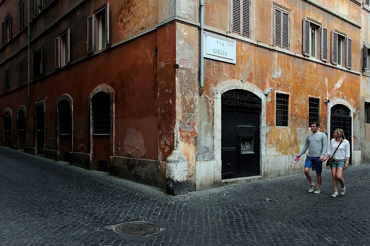
A rione is a traditional district of the city of Rome. The word has been used since the fourteenth century and comes from the Latin regio, region, which became rejones in the Middle Ages. Rome's historic center is made of twenty-two of them, each with a number in Roman numerals, a name and a coat of arms. On street plaques and maps a rione is written with the letter R and its number: Trastevere is R. XIII, Prati R. XXII. Everything outside them belongs to the larger quarters of the modern city, marked Q.
For a visitor the rioni are the most useful way to hold the city in your head. A sight on this site always carries its rione: the Colosseum stands in XIX, Celio; the Pantheon in IX, Pigna; Piazza Navona in VI, Parione. Two of the eighteen stand outside the rioni altogether, and two more stand in another country: St. Peter's and the Vatican Museums are in Vatican City.
From regions to rioni
According to tradition, King Servius Tullius first divided the city into four regions. Augustus made fourteen, which lasted through the empire, and all but one, Trans Tiberim, lay on the left bank of the Tiber. After the fall of Rome the population shrank and the division was lost. In the twelfth century the people began, unofficially, to speak of twelve districts, still called regio in Latin and rione in the spoken tongue. By the thirteenth century there were thirteen, each headed by an officer called the caporione.
In 1586 Pope Sixtus V added Borgo, the district between the Vatican and the river, as the fourteenth. The numbers held until Rome became the capital of Italy. In 1874 Esquilino was carved out of Monti to make fifteen; in the early twentieth century others were split and the first districts beyond the walls were added, and in 1921 the count reached twenty-two, with Prati the last. Since 2013 all twenty-two have belonged to the first municipio of the city.
The marble plaques of 1744
In 1744 Pope Benedict XIV, tired of disputes over where one district ended and the next began, had Count Bernardini redraw the boundaries. Marble plaques marking the border of each rione were set into the walls of the houses along its edges that year, and many of them are still there. Look up at street corners in the old center and you will see them, carved with the rione's name and number, a small record of eighteenth-century administration that doubles as a map.
Napoleon's French government later reorganized the city into eight districts and fixed a name plate in every street; the older rioni came back after his fall.
Reading the names
The names are a history of the city in miniature. Some come from ancient buildings: Colonna from the Column of Marcus Aurelius, Castro Pretorio from the barracks of the Praetorian Guard, Parione from a great wall, perhaps part of Domitian's stadium. Some come from the land: Monti from its hills, Regola from the sand the Tiber left after floods, Ripa from the riverbank. Some come from churches, like Sant'Eustachio and San Saba, and one from a giant bronze pine cone, Pigna, whose namesake now stands in a Vatican courtyard.
Testaccio takes its name from Monte Testaccio, a hill built entirely of broken clay amphorae from the river trade of antiquity, still a rich source of evidence about everyday Roman life. The people of Regola were nicknamed tail-eaters, after the oxtail stew, coda alla vaccinara, made by the rione's many butchers.
Their coats of arms are just as specific: three green mountains for Monti, three swords for Trevi, a rudder for Ripa, an amphora for Testaccio, the silhouette of Hadrian's tomb for Prati.
Two rioni with walls of their own
Two districts were once enclosed inside the city. In 1555 Pope Paul IV, by the bull Cum nimis absurdum, confined the Jews of Rome to a ghetto in Sant'Angelo, the smallest rione, in the low ground by the Tiber near the Theatre of Marcellus, an area now bounded by Via del Portico d'Ottavia and the river. Apart from brief periods under the Roman Republics and Napoleon, whose troops made a point of pulling down its walls, the ghetto remained under papal control until the capture of Rome in 1870.
Borgo, across the river, has walls for the opposite reason. In the ninth century the district around St. Peter's was plundered by Saracen raiders and swept by fire, the fire of 847 that Raphael later painted in the Vatican. Pope Leo IV answered by enclosing it, walking barefoot with the clergy and people around the circuit of the new walls on 27 June 852, and the district took the name the Leonine City. Its coat of arms still shows a lion.
The walls as a boundary
Most of the rioni lie within the Aurelian Walls, built between 271 and 275 under the emperor Aurelian. The walls ran for about twelve miles around the seven hills, the Campus Martius and, across the river, Trastevere, and they defended the city until 20 September 1870, when Italian troops breached them near the Porta Pia and took Rome. Long stretches still stand, and the gates still mark the way out: the Appian Way leaves by the Porta San Sebastiano, and the road from the north enters at Piazza del Popolo.
The rioni added after 1870 were built on the villas and vineyards inside the walls, or just beyond them. Ludovisi was laid out from 1886 over the gardens of the Villa Ludovisi; Prati was the only one built outside the walls of Pope Urban VIII.
Using the numbers
The order has a logic. The low numbers, I to XII, are the old districts on the left bank, from Monti on its hills to the bend of the river and down to the Aventine. XIII is Trastevere, across the water, and XIV is Borgo, beside the Vatican. XV to XXI were created from 1874 onward, mostly on the edges of the old city, and XXII, Prati, lies north of Borgo.
If you are planning a stay, the neighborhoods page groups the rioni by what they are like to stay in, and the itineraries page follows them on foot.
Seen on the way
More photographs
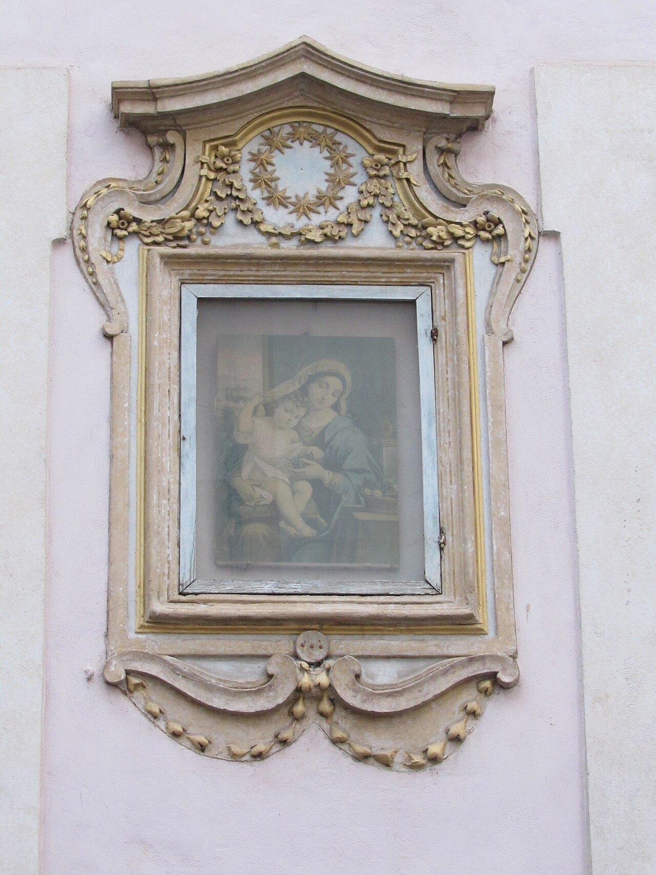
A small painted Madonna in a carved and gilded frame on a white wall in Sant'EustachioFredSeiller, Wikimedia Commons, CC0 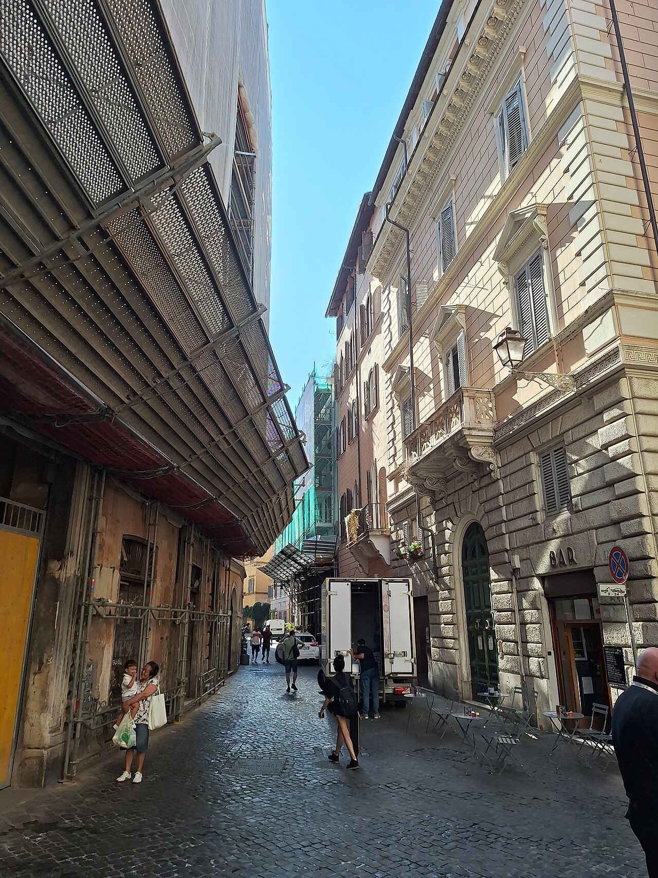
Via del Governo Vecchio, a narrow street of old palaces in the rione of ParionePere prlpz, Wikimedia Commons, CC BY-SA 3.0 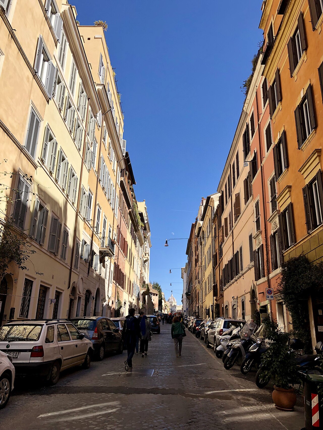
Via Panisperna in Monti, a straight street of ocher houses running downhillThomas Woodtli from Zürich, Switzerland, Wikimedia Commons, CC BY-SA 2.0